A new online tool launched by New Mexico State Representative Marianna Anaya to document suspected Immigration and Customs Enforcement (ICE) activity has inflamed partisan tensions and prompted calls for an immediate investigation — amid warnings that the platform’s ability to accept precise coordinates could pose safety and privacy risks.

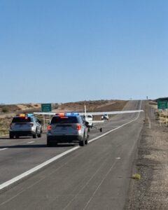
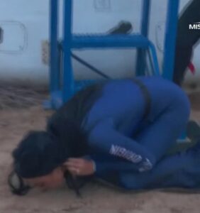
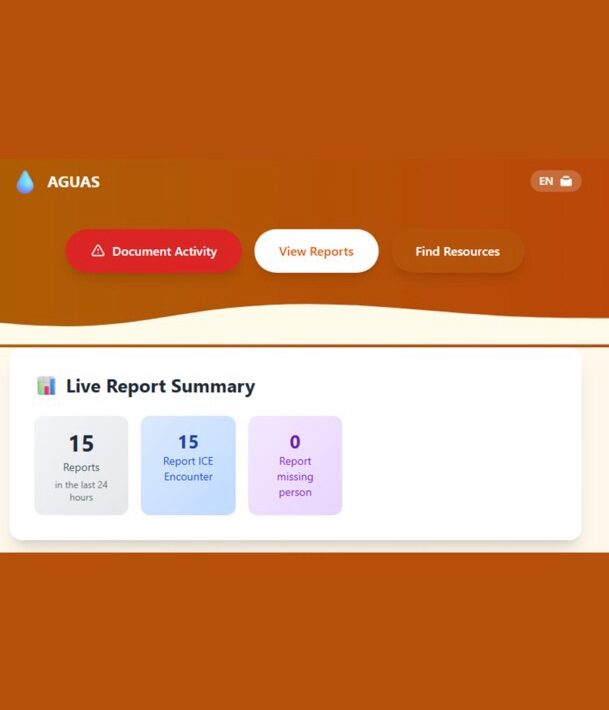
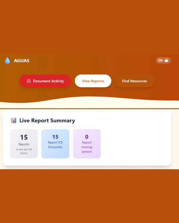
Rep. Anaya’s office last week unveiled AGUAS-NM.com, a public map where users can submit reports, photos and videos of alleged ICE “encounters” across New Mexico. The site marks submissions as “unverified” until community partners or local officials confirm them, and it carries a disclaimer saying reports may be inaccurate and should not be used to interfere with law enforcement. The tool was built, Anaya told reporters, by a volunteer in her office to respond to “widespread — but hard-to-verify — reports of masked ICE agents arresting people across the state.”


But conservative activists and some Republican officials are calling for an immediate probe into the project, arguing that allowing the public to post exact geographical coordinates of alleged enforcement actions could be exploited by criminals or foreign actors, and could jeopardize public safety. Social posts pushing for an inquiry have circulated widely on X (formerly Twitter), amplifying criticism and sparking a partisan uproar.
What the site does — and what it doesn’t
AGUAS-NM’s stated purpose is to increase transparency around federal immigration enforcement in New Mexico and to help communities track and verify incidents that might otherwise be spread as rumors. According to coverage of the launch, the site differentiates verified from unverified reports and allows community organizations to help confirm entries; it also warns users not to use the map to interfere with law enforcement operations.
Despite those safeguards, critics say the map’s ability to accept exact coordinates and media could be abused — from doxxing and vigilante responses to targeted attempts to mislead or manipulate the public record. That concern is what’s driving calls for oversight, opponents say: a publicly editable database tied to locations is an unusual tool for a legislator’s office, and its governance, security and legal exposure have not been fully explained.
Legal and ethical fault lines
Legal experts note two separate but related risks. First, there’s the risk of misinformation: crowdsourced reports are often incomplete or inaccurate, and a map that aggregates unvetted claims can amplify false narratives unless verification is rigorous. AGUAS-NM’s “verified/unverified” distinction aims to mitigate that, but critics argue verification procedures must be transparent and resourced. Second, there’s privacy and safety: publishing precise locations in real time — even if intended to document enforcement — can expose individuals involved (including non-targets), witnesses or private property to harassment or criminal exploitation.
Importantly, calls circulating online that encourage “flooding” the database with false data — a tactic some have proposed to “render it useless” — would likely run afoul of laws and platform terms. Deliberately submitting false reports to an investigative database can be illegal (depending on jurisdiction and conduct) and would undermine community safety and public trust. Public-interest critics and civil liberties groups typically recommend policy and oversight fixes rather than sabotage.
What investigators should look at
If a formal review is launched, experts say it should examine several concrete areas:
Data governance and retention: Are precise coordinates stored? Who has access? How long is data kept? Verification workflow: Who verifies reports, with what standards, and how are errors corrected? Privacy protections: Does the site scrub or anonymize personally identifying information? Are opt-out or takedown mechanisms in place? Security controls: Is the platform hardened against malicious mass submissions, scraping, or foreign interference? Legal exposure: Could the site’s operators face liability for facilitating interference with law enforcement or for hosting defamatory claims?
Responses and next steps
Rep. Anaya has framed the platform as a transparency tool born of community concerns, and the site includes warnings about accuracy and not interfering with law enforcement. Supporters say community documentation can hold agencies accountable when oversight mechanisms are limited. Nonetheless, the mixed public response suggests a quick, transparent review would help: publishing the site’s privacy policy, technical safeguards, verification procedures and an independent audit plan could reduce fears and improve legitimacy.
For critics who want action beyond online outrage, lawful avenues include contacting state ethics or oversight bodies, requesting records and explanations from Anaya’s office, or calling for a legislative inquiry — rather than encouraging destructive or unlawful tactics.
Bottom line
A community-sourced map of federal enforcement activities raises legitimate questions about verification, privacy and safety — and those questions deserve prompt, public answers. But experts and civil-society organizations caution that trying to “break” such a tool by flooding it with false data would be both unethical and potentially illegal. A transparent audit and clear rules of engagement would better serve both public safety and the public’s right to know.