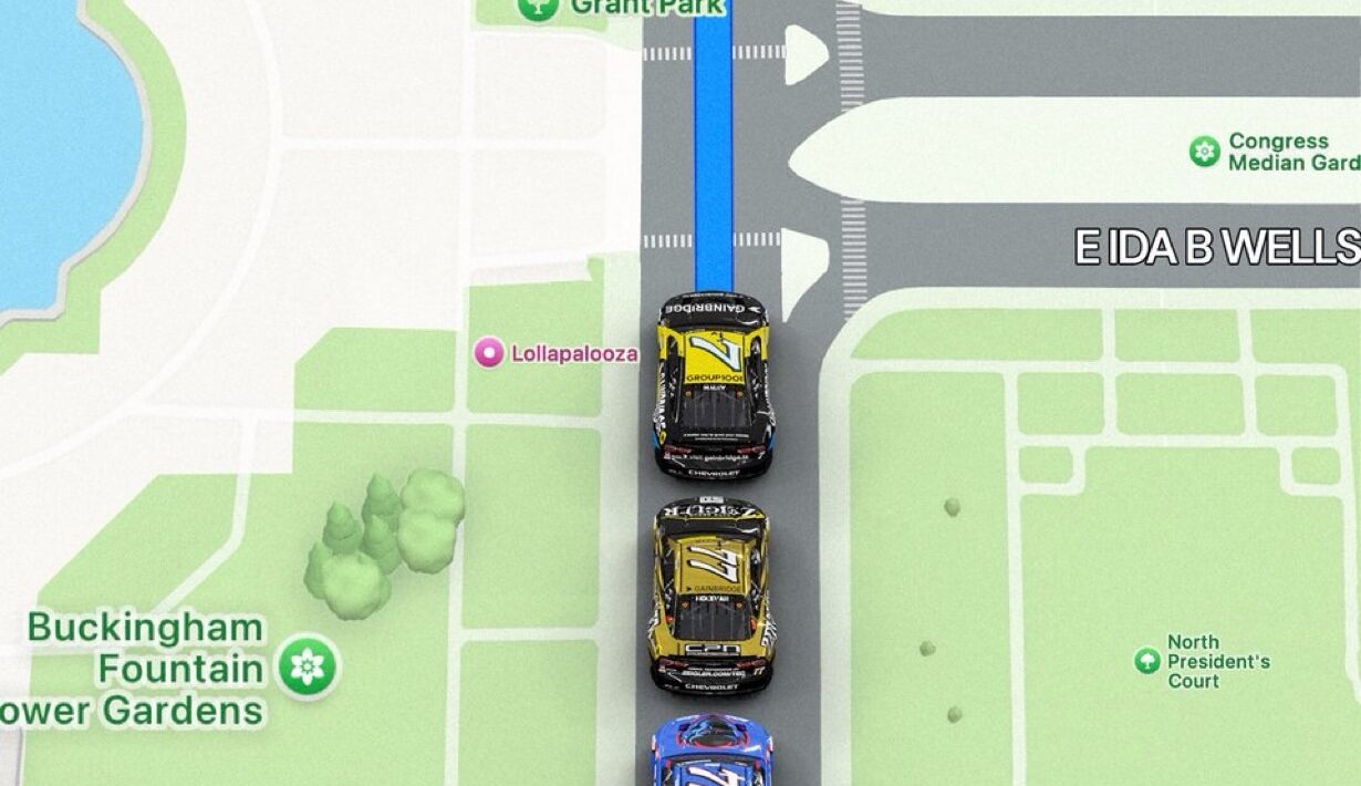
In a sport where speed, precision, and adrenaline reign supreme, one NASCAR venue stands out for a very different reason: you can actually plug it into your GPS.
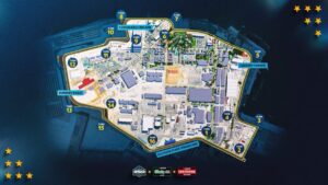
The Chicago Street Course, NASCAR’s groundbreaking addition to its Cup Series calendar, isn’t just a racetrack—it’s a stretch of public streets transformed into a high-speed battleground. Unlike traditional oval tracks or purpose-built road courses, this circuit winds through the heart of downtown Chicago, past iconic landmarks like Buckingham Fountain, Grant Park, and Lake Shore Drive.


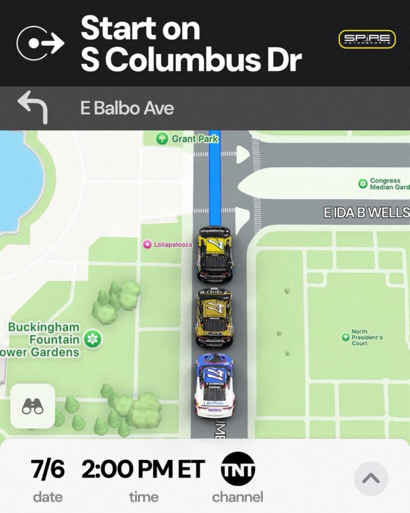
When drivers take the green flag here, they’re racing on roads that, for the other 364 days of the year, are open to commuters, cyclists, and tourists snapping photos of the skyline. Fans can trace the exact route on their phones, navigate it themselves, and imagine the roar of stock cars echoing off skyscrapers.
This unique setup gives NASCAR a fresh urban flavor and makes the Chicago Street Course a track like no other. It’s a circuit where GPS directions and racing lines meet, and where fans and drivers alike can explore the course long after the checkered flag has waved.
So next time you’re in Chicago, fire up your maps app and take a lap. Just be sure to watch your speed—you won’t have a pit crew to bail you out of a ticket.
Related Posts:


NASCAR Driver Chase Briscoe Partners with Free Bird Southern Spring Water as New Brand Ambassador 💧🏁


Get Ready for the Thunder: The Dodge NHRA Nationals Powered by Direct Connection Are Almost Here! 💨🔥